Volcanoes and Geology: Yellowstone's Explosive Past as a Classroom
- Caleb Mullenix
- Oct 21, 2025
- 5 min read

Preparing your students for a Yellowstone expedition involves understanding one of Earth's most dynamic geological laboratories. Yellowstone National Park sits atop a supervolcano that has shaped continental landscapes for millions of years, offering unparalleled opportunities for hands-on earth science education. Ensuring your students grasp the magnitude and significance of Yellowstone's geological processes will transform their understanding of how our planet functions.
Understanding Yellowstone's Supervolcano System
Begin by introducing students to Yellowstone's explosive timeline, which spans 2.1 million years of catastrophic eruptions. The park's current landscape represents the aftermath of three massive caldera-forming eruptions that occurred 2.1 million, 1.3 million, and 640,000 years ago. These eruptions were approximately 6,000, 700, and 2,500 times larger than the 1980 Mount St. Helens eruption, respectively.
Emphasize the continental scale of these events to help students comprehend geological time and volcanic power. Volcanic ash from Yellowstone's eruptions blanketed western North America, with regions within 200 miles receiving ash accumulation up to mid-calf height. Even distant locations across the continent experienced several inches of volcanic debris, while wind-carried particles affected global climate patterns.
Create pre-trip activities that demonstrate volcanic scale through comparative exercises. Have students calculate the volume differences between Yellowstone's eruptions and more recent volcanic events. Encourage students to map ash distribution patterns on continental maps, reinforcing concepts about wind patterns, geological time scales, and the interconnectedness of Earth systems.
The Yellowstone Caldera: A Living Laboratory
Direct student attention to the current Yellowstone caldera, formed 640,000 years ago and measuring approximately 30 by 45 miles. This massive depression represents the collapsed roof of an emptied magma chamber, providing students with visible evidence of subsurface geological processes.
Explain how two resurgent domes within the caldera: Sour Creek Dome and Mallard Lake Dome: continue to rise and fall as magma and hydrothermal fluids move beneath the surface. Scientists monitor these movements continuously, with magma potentially located as shallow as 3 to 8 miles beneath Sour Creek Dome and 8 to 12 miles beneath Mallard Lake Dome.
Prepare students to observe calderas as dynamic systems rather than dormant features. Since the last major eruption, Yellowstone has experienced 60 to 80 smaller eruptions, with the most recent occurring at Pitchstone Plateau approximately 70,000 years ago. Advise students to look for evidence of these more recent volcanic activities during their exploration.
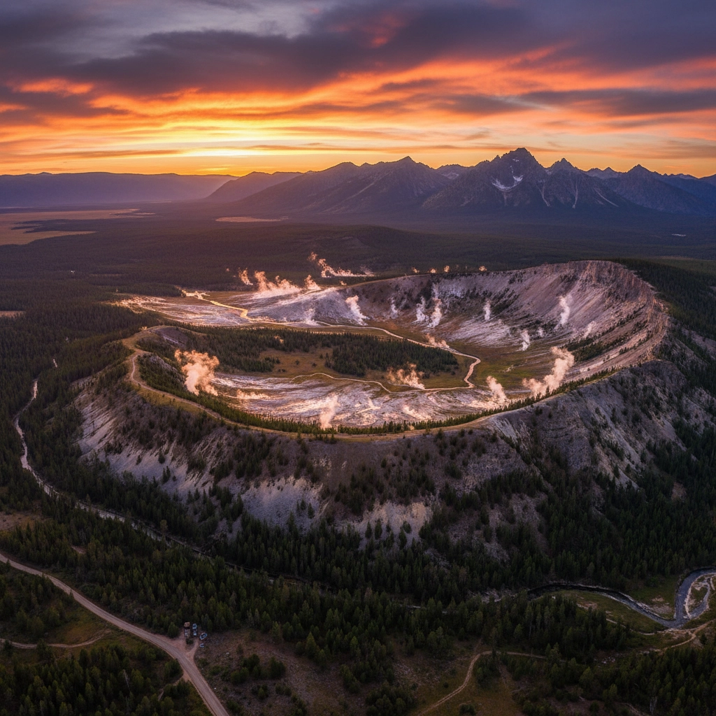
Hydrothermal Features as Geological Indicators
Yellowstone's hydrothermal features serve as direct windows into the subsurface heat engine driving the park's geological activity. Prepare students to understand geysers, hot springs, fumaroles, and mud pots as surface expressions of the underlying magma system.
Begin hydrothermal education by explaining the water cycle's intersection with geothermal heating. Surface water percolates deep underground, becomes superheated by proximity to magma, and returns to the surface through fracture systems. This process creates the spectacular features students will observe during their expedition.
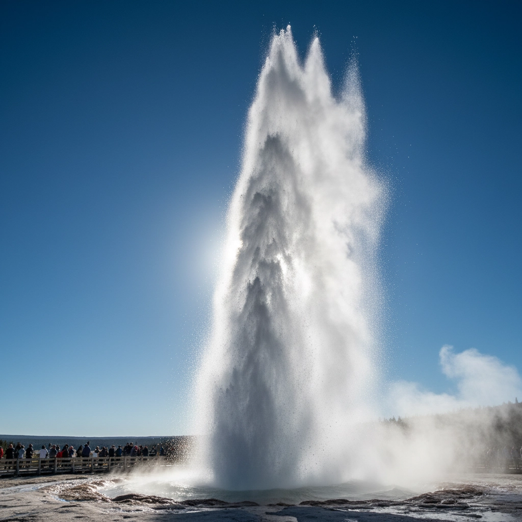
Encourage students to document temperature variations, eruption patterns, and mineral deposits around hydrothermal features. Create observation worksheets that prompt students to record water temperatures, mineral coloration, and gas emissions. Emphasize safety protocols around thermal features, as ground temperatures can exceed 200°F and water temperatures often approach boiling.
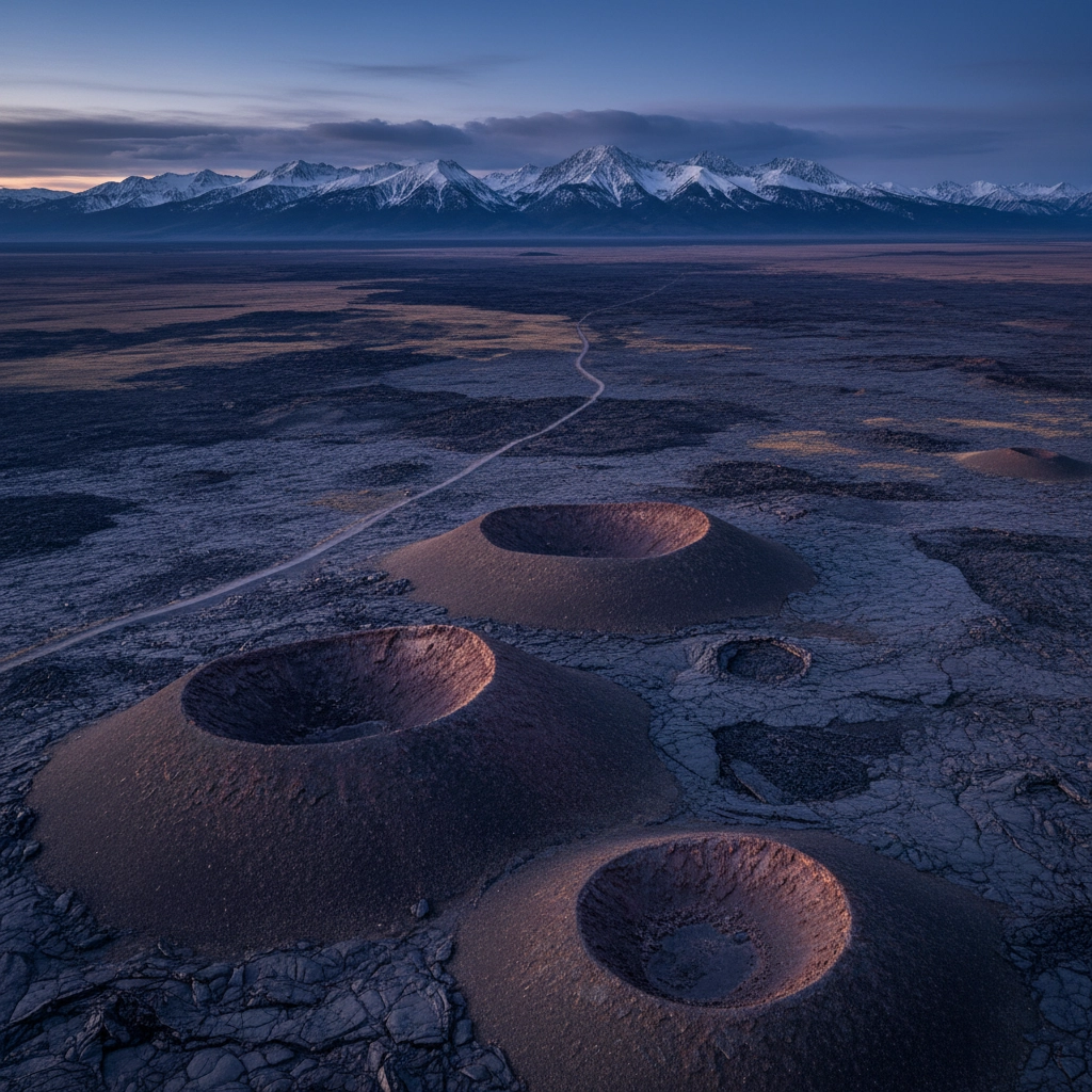
The Hot Spot Track: 17 Million Years of Movement
Introduce students to the concept of mantle hot spots through Yellowstone's 17-million-year journey across the Snake River Plain. This geological story demonstrates plate tectonics in action, as the North American plate has moved southwest over a stationary mantle plume, creating a trail of volcanic deposits stretching more than 750 kilometers across southern Idaho.
Explain how at least six other large volcanic centers preceded Yellowstone along this path, each generating multiple caldera-forming eruptions before crustal movement shifted magmatic activity northeastward. This progression provides students with concrete evidence of continental drift and deep Earth processes.
Create mapping exercises that trace the hot spot's path through time, connecting Yellowstone's current location to its volcanic predecessors. Encourage students to predict where the hot spot might create future volcanic activity based on current plate movement rates.
Earthquake Activity and Crustal Deformation
Prepare students to understand seismic activity as an integral component of Yellowstone's geological processes. The region experiences frequent small earthquakes as magma movement, hydrothermal circulation, and crustal adjustment generate ongoing seismic activity.
Explain how scientists monitor earthquake patterns to understand subsurface processes and assess volcanic hazards. Recent earthquake swarms often correlate with changes in hydrothermal activity or ground deformation, providing real-time insights into the dynamic systems beneath Yellowstone.
Encourage students to explore seismograph data during their visit, connecting earthquake locations and magnitudes to geological features they observe. Emphasize how continuous monitoring helps scientists distinguish between normal background seismicity and potentially significant changes in volcanic activity.
Hands-On Learning Activities for Student Expeditions
Create structured observation protocols that maximize learning opportunities throughout your Yellowstone expedition. Begin each day with geological briefings that connect previous learning to specific features students will encounter.
Develop rock and mineral identification exercises using Yellowstone's diverse geological formations. Students should learn to distinguish between rhyolite, basalt, and obsidian while understanding how different magma compositions create varied volcanic rocks. Provide hand lenses and identification charts to enhance observation skills.
Encourage students to maintain geological journals documenting their observations, questions, and hypotheses about features they encounter. Include sketching exercises that require students to illustrate geological formations, hydrothermal features, and rock relationships.
Design temperature measurement activities around hydrothermal features, using appropriate safety equipment and maintaining safe distances from thermal areas. Students can create temperature maps of thermal areas while learning about heat flow and subsurface processes.
Wildlife Adaptations to Geothermal Environments
Prepare students to observe how wildlife has adapted to Yellowstone's unique geothermal environment. Many animals utilize thermal areas for warmth during harsh winters, while specialized microorganisms thrive in extreme temperature conditions around hot springs and geysers.
Students should understand how geothermal features create localized microclimates that support diverse ecosystems. Thermal areas often remain snow-free during winter, providing crucial habitat for ungulates and creating year-round water sources for wildlife.
Encourage students to document wildlife behavior around thermal features while maintaining appropriate distances for both safety and animal welfare. Create observation sheets that prompt students to record species locations, behaviors, and apparent adaptations to geothermal conditions.
Forest Fire Ecology and Geological Interactions
Explain how Yellowstone's fire ecology intersects with its geological processes, creating complex relationships between volcanic soils, hydrothermal features, and forest regeneration. The 1988 fires, which burned approximately one-third of the park, provide ongoing case studies in ecological succession and soil development.
Volcanic soils created by ancient eruptions support diverse forest communities, while thermal areas often serve as natural firebreaks during major wildfire events. Students should observe how different geological substrates support varying vegetation types and fire recovery patterns.
Prepare students to identify fire-adapted tree species and understand how volcanic soils influence forest composition and growth rates. Create exercises comparing vegetation patterns on different geological formations to demonstrate soil-plant relationships.
Practical Preparation Guidelines for Educators
Ensure comprehensive preparation by reviewing geological maps and feature descriptions before your expedition. Familiarize yourself with park regulations regarding thermal feature access and student supervision requirements around potentially hazardous geological features.
Create emergency procedures specifically addressing geological hazards, including protocols for earthquake events, unstable ground conditions, and accidental thermal feature contact. Share detailed safety guidelines with students, parents, and chaperones well before departure.
Coordinate with park rangers and educational specialists to enhance your geological instruction through expert-led programs and specialized educational resources. Many ranger programs focus specifically on geological processes and can significantly augment classroom preparation.
Advise students to bring appropriate field notebooks, writing materials, and basic geological tools while emphasizing Leave No Trace principles around sensitive geological and hydrothermal features. Stress the importance of observation without collection in this protected environment.
Your Yellowstone geological expedition will provide students with transformative understanding of Earth processes, volcanic systems, and the dynamic nature of our planet. Thorough preparation ensures maximum educational impact while maintaining the safety and respect essential for meaningful geological education in one of the world's most remarkable natural laboratories.
Comments